Research
Advancing UN Sustainable Development Goals through AI Research.
Our research blends foundational and applied AI to directly advance two UN Sustainable Development Goals: securing cleaner energy from the subsurface (SDG 7 — Affordable and Clean Energy) and monitoring our planet to adapt to a changing world (SDG 13 — Climate Action). Select any of the four themes below to explore the research.
Computer Vision for the Subsurface
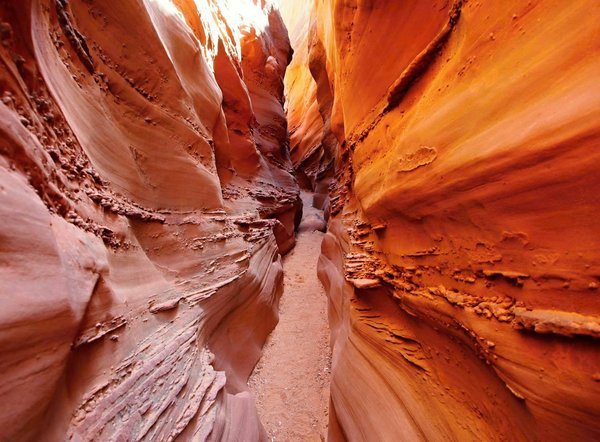
Computer Vision for the Subsurface
Our work on computer vision for cores demonstrate an increase not just in speed of analysis but also accuracy when compared to humans

A very large part of the energy that you use today comes from the geology beneath your feet. This includes conventional oil, gas and coal, but also cleaner sources of energy such as geothermal energy, carbon capture and storage for conventional reservoirs, geological hydrogen, and even for aeolians, a characterization of the subsurface is necessary for engineering. The subsurface is also a vital reservoir of drinkable water, and of brines rich in critical minerals. Hence, a proper characterization of geology in the subsurface is essential to human activites.
Computer vision for core images
In a paper led by Sonia Liu and published in 2026, we demonstrate that object detection algorithms can be used to predict grain-size, and that this data can be used as features for a random forest classifier to determine Dunham textures (read paper here)
Our often cited Dawson et al 2023 paper demonstrates that convolutional neural network outperform humans in classifying carbonate facies in digital cores, and that transfer learning is an effective technique to train CNN provided the dataset is at least 40k strong images (full paper)
In our Mamode et al 2025 paper we demonstrate that representation learning, or semi-supervise learning with SimCLR, is superior to transfer learning for core deformation predictions. This naturally guides us towards foundation models for cores (full paper here).
Beyond facies description, object detection can improve core description by increasing identification of skeletal components by orders of magnitudes, allowing for very detailed data gathering at the scale of full wells (Dawson et al, 2024, full paper here).
Computer vision can be used with multimodal data. In the case of our Nathwani et al 2023 paper (see here), we used cathodoluminescence images of zircons to distinguish between Cu-bearing and non Cu-bearing batholithes.
Automatic core description is a big research theme in our lab, as previous studies have shown that humans are inconsistent in descriptive tasks. This is important, because the facies defined during core descriptions are used to interpret environmental changes, and also petrophysical classes for subsurface energy. Our work to date includes supervised classification and object detection, semi-supervised learning for core deformation, and rethinking core description as a regression task rather than a classification. We are now working towards foundation models for generalizable downstream applications.
Leveraging Generative AI for Subsurface Logs
Generative AI is more often associated with LLMs and vision-language models, less with subsurface geology. However, in a series of progressively more complex projects, we show that generative AI can help geologists interpret the subsurface more accurately than if they rely solely on log data. We first explore how formation microscanner (FMS) data can serve as a prior to a generative model (Pix2PixHD) and demonstrated that geologists were more accurate when describing Dunham texture on synthetic cores than on raw FMS data. More recently, we continued this work by integrating conventional logs and FMS data in a new architecture for the generator model of Pix2PixHD, achieving even more realistic results.
In our original Baharuddin and John, 2025, work (paper here), we simply co-opted Pix2PixHD into accepting three FMS pads as priors to generate synthetic core images.
Images generated by Pix2PixHD when using only FMS data (Baharuddin and John, 2025,paper here).
To improve on images generated by Pix2PixHD, we developed the log-gated dual-path conditional U-net generator. The new model integrates conventional logs with FMS data to generate synthetic core images (Shi and John, 2026, CVPR workshop paper here).
Images generated by our new log-gated dual-path conditional U-net generator. This work (Shi and John, 2026) was published as a CVPR workshop paper (full paper).
Seismic Processing and Interpretation
Seismic data is a key source of information for subsurface geology, but its processing and interpretation can be time and resource intensive, as well as subjective. We are working on novel mathematical loss functions for neural network to improve seismic processing such as missing trace reconstruction or inversions. These AI techniques are orders of magnitude faster than conventional inversion or reconstruction techniques. For automatic interpretation of seismic stratigraphy, we overcome the issue of lack of labelled training data by generating realistic synthetic data. We have experimented with several techniques to achieve this, including generating simple seismic termination and full geological cross sections with forward stratigraphic modelling. We then use forward modelling of a seismic impendance response of the synthetic geology to obtain our training data. We demonstrate on actual data that the trained models perform well.
To build complex clinoform geometries for our synthetic seismic we used a forward stratigraphic model called DionisosFlow (Algharbi et al, in press).
Once the synthetic cross sections are created, we randomly fill layers with rock properties and forward-model their seismic responses (Algharbi et al, in press).
We developped a new method called the Wiener Loss to regularize missing seismic traces reconstructions (AlSalmi and John, in review)
We used the Wiener Loss regularization to build seismic inversion surrogate models in geothermal fields (AlSalmi and John, in review)
In some of our earlier work, we build very simple geometric seismic termination models with the Bruge library and we then forward modelled a seismic response (Algharbi et al, 2025, see full paper here).
Training on synthetic seismic overcomes the issue of lack of good, labelled training data. But we also demonstrate that when applied to real subsurface seismic, our algorithm produces useful probability maps of seismic terminations (Algharbi et al, 2025, see full paper here).
We automate geological description tasks — core logging, facies classification, seismic interpretation — using convolutional and transformer-based vision models and generative AI.

Whether you work on core images, downhole logs or seismic data, computer vision can usually be the right tool to improve the extraction of meaningful information from these unstructured data format
Digital Twins & Scientific Simulations
Digital Twins & Scientific Simulations
Both statistical and physical simulations are important to create subsurface Earth models honoring sparse well and seismic ground truthing. Geostatistics and forward stratigraphic modelling (e.g., CRONOS, DionisosFlow, CarboCAT) are two well-known approaches to produce Earth models, and these can then be used in flow simulations. Increasingly, deep learning is important to create fast, calibrated Earth models. We have a long history of working with simulations for the subsurface.
Simulating sediment architectures to flow in reservoirs
Much of our research explores how different modelling philosophies can be combined to understand sedimentary systems and reservoirs. Geostatistical methods, for example, are fast and honour well data perfectly, but because they are not anchored in physics they can produce unrealistic reservoir geometries; we have developed geostatistical tools such as pluri-Gaussian simulations to capture cyclical sedimentary successions. Forward stratigraphic models offer the complementary trade-off: they may not reproduce well data exactly, but they always yield physically realistic geometries. This makes them well suited to questions about depositional controls — from Cretaceous carbonates in Oman, to high net-to-gross deposits in the Gulf of Mexico, to Jurassic organic shales in the Middle East. A third strand of our work turns to dynamic flow simulation, for instance predicting water breakthrough in oil and gas reservoirs, including NURBS-based techniques for modelling channel deposits in Saudi Arabia. Together these approaches illustrate the range of numerical methods we use, and how their contrasting strengths can be brought to bear on a given problem.
Earth modelling starts with capturing the geometry and nature of rocks, as we did in our Jacquemyn et al 2017 paper on the Jurassic of Saudi Arabia (paper here). We then used NURBS to build an Earth model and simulate lateral sweep efficiency.
PhD student Thomas Le Blevec developed pluri-Gaussian simulations during his PhD to better characterize cyclical and asymetrical sedimentary packages (example from Le Blevec et al., 2018, paper here)
Forward stratigraphic modelling emulate geological processes through geological times: once the boundary conditions and seafloor geometry are set, the simluation result is deterministic. Exploring model uncertainty will require an ensemble of models. In this example, we modelled different end-members for the geometry of the Lower Cretaceous carbonates in the suburface of Oman (Al Salmi et al, 2019, paper here)
We used an ensemble of models when exploring organic deposition in the Jurassic Najmah formation of Kuwait (Al-Wazzan et al, 2022, paper here). We could thus constrain the environmental conditions needed to produce one of the world's first class source rock.
Often the ultimate goal of a static Earth model is to represent the distribution of petrophysical properties in the subsurface. In our Fitch et al 2014 paper, we demonstrate how design experiment of simulations help determine lateral sweep efficiency and residual oil in place in Jurassic reservoirs from Morocco. This paper won the 2015 Norman Award for best paper.
Accelerating geological simulations with deep learning surrogate models
One of the drawback of physics-driven simulation is that they can be very slow to compute. This is especially problematic for geological simulations: because the inital conditions of the model are usually poorly constrained, an ensemble of simulations needs to be run, each costing a significant amont of computation. We use deep learning as a surrogate for these simulators: training convolutional and recurrent neural networks on libraries of forward model runs, then using the trained surrogates to explore parameter space orders of magnitude faster. This enables rapid sensitivity analysis, quick identification of most compatible simulation parameters, and orders of magnitude faster solving of complex simulations. We couple this with data assimilation techniques to improve the calibration of models, thus ensuring that our ensembles are composed of mostly calibrated runs.
A simple example of AI surrogate for stratigraphic modelling: we used a Generative Adversarial Model (GAN) as an autoregressive generator to produce simulation results at a fraction of the computational cost needed by DionisosFlow. These images represent each a map view of a carbonate platform, with results generated by our GAN compared to the actual simulation results. Work of master student Adiba Feizal, 2023.
The starting point of any surrogate model is training data: we generated with the help of our partner TOTAL OneTech hundreds of variants of forward stratigraphic and diagenetic models of carbonate ramps and isolated platform. We used TOTAL Energy's CRONOS suite for this step.
Amin Nadimy, a postdoc within our group, experimented with Fourier Neural Operators as potential surrogate models for Richard's equation. Richard's equation is a key equation for pressure and saturation of water or other fluids in aquifer, it is difficult to solve, and essential to model diagenesis.
The results of training even a simple FNO on our data clearly shows that this architecture is capable of results similar to full physics simulators, but at a fraction of the computational cost. Work of Amin Nadimy.
But how do ensure that models are well calibrated? Postdoc Liang Wang has experimented with different sensitivity analysis for the CRONOS simulation, and can identify simulation parameters (each line of the plot) that impact the outcome of the simulation most over time.
The net value of sensitivity analysis is that we are now able to use data assimilation with an ensemble smoother method to ensure the ensemble of simulation are optimally calibrated for the wells, whilst still capturing the uncertainty range of the distribution away from control points. Work of Liang Wang.
AI in weather forecasting
Numerical weather prediction and climate modelling have long been dominated by physics-based models that are computationally expensive and imperfect in their parameterisations. AI offers a complementary approach: learn the statistical relationships embedded in decades of reanalysis and observational data to produce fast, accurate forecasts. Although our team is focusing mostly on geological simulation, we have estabished some collaboration with atmospheric scientists and have competed - and won - in weather forecast hackatons.
Our team won top 5 position in an IEEE hackaton to improve hyperlocal weather prediction. We used the output of large forecast models using full physics, and refined them using statistical machine learning - our results are availabe in a paper published in 2026.
We also started important collaboration with different meteorological society, for instance, working closely with the BMKG indonesia in their mission to improve weather prediction as well as Earthquakes and tsunami prediction. Cedric John visited the BMKG in 2024.
Blending geostatistics, forward stratigraphic modelling, and now deep learning, we turn scattered data into fast, calibrated models ready for flow simulation.

Planetary Observation & Climate Resilience
Planetary Observation & Climate Resilience
Tracking environmental changes requires a mix of in-situ measurments, and remote sensing with drones, remotely operated vehicles, and satellite imagery. We use artificial intelligence on this data to automated it's interpretation, and improve the way we can monitor our planet and other planets in the solar system.
AI for ocean observations
Computer vision has a major role to play in the study of the oceans. For instance, we worked on automating the classification of deep-sea biota using advanced deep learning models trained on remotely operated vehicle (ROV) image datasets. We developed a dataset with nearly 4,000 images across 33 organism classes, achieving classification accuracies up to 65% using Inception-ResNet architecture. This work aims to improve biodiversity assessments and conservation efforts in remote marine environments.
We also have spent considerable efforts developping tools to automate the recovery and correction of marine scenes in satellite images, notably to monitor coral reefs. The issue is that most operator's corrections (e.g. NASA, ESA) rely on dark vegetation or other continental features to auto-correct the images. When one is trying to build satellite time-series from Islands or coral reefs, it is difficult because the quality of the scene advertised by the operator cannot be always trusted, and the corrections can be inconsistent. Machine learning can overcome these issues.
Example of deep-sea biota dataset from ROV imagery. We published this work in our Deo et al. 2024 paper in Nature.
We used the ROV data to demonstrate that classifier for deep sea biota around coral reefs could be trained, as demonstrated by these Receiver-Operator curves ( Deo et al. 2024).
In our Al-Zayer et al 2025 paper we tackle the challenge of correcting marine scenes using statistical machine learning, as demonstrated by the workflow figure here.
One example of an important step in marine scene correction is the Otsu correction, that make each individual image more consistent, allowing a monitoring of coral reefs through time ( Al-Zayer et al 2025)
Ultimately, our machine learning pipeline allows users to identify different environment of deposition automatically thanks to their spectral characteristics; we use superpixels to achieve this ( Al-Zayer et al 2025).
These methods allow us to monitor a given coral reefs over multiple decades. We demonstrated this by monitoring corals offshore Oman over 4 decades, at a much higher resolution than previously achieved thanks to machine learning. This work clarified the mechanism of reef decay in the region, and quantify the rate of change (AlZayer et al, 2026)
Exploring the solar system with AI
One of the most exciting things about remote sensed data is that it is not limited to Earth. In fact, we have a growing collection of data from other planets in the solar system, notably Mars and the moon. Mars offers some exciting challenges, with multimodal data comprising satellite imagery, high-resolution imagery, hyperspectral data, and in-situ rover data.
We worked extensively on the Compact Reconnaisance Imaging Spectrometer for Mars (CRISM) instrument, a satellite capturing data across Mars in a number of different wavelength. This hyperspectral data is powerful, allowing us to make inference about the surface composition of the planet. However, the data quality of the instrument was declining over time, and became unsable. We demonstrated that AI could be used to denoise the signal, and to confidently identify minerals with a calibrated confidence. This approach can be extended in future to other bodies in the solar system.
Example of image denoising on Mars. The top image represents smectite abundance in a CRISM spectra on Mars early in the life of the instrument. The middle image represents the same scene, but taken later, when CRISM had more noise. The last image represents the middle image denoised with our classifier - note that this image is cleaner than even the earliest image, demonstrating the value of deep learning denoising (Platt et al, 2025).
Example of the modified UNet architecture used to denoise CRISM images (Platt et al, 2025).
But how about classifying the main mineralogy per pixel? In our follow-up Platt et al 2026 work, we show that a hybrid machine learning model is capable of both denoising and classifying pixels with a high degree of accuracy.
Our hybrid classifier is better calibrated than standard classifier, i.e. the output probabilty of the model is closer to the actual probably of a correct classification. This means we can use the probabily to filter pixel by confidence (Platt et al 2026).
We demonstrate this on Mars by plotting only the pixels with a 75% probability of being correct. There is a clear correspondence between our automatic mineralogy classification (Platt et al 2026), and the manual work of others at Jezzero Crater. This demonstrate the value of automated pixel classification with deep learning.
We track environmental change over time using multi-temporal remote sensing data and deep learning, from Earth's oceans to Mars' deserts.

Beyond Earth Science: Foundational AI
Beyond Earth Science: Foundational AI
From fundamental AI to applications
Computer vision is a versatile tool, and some of our work expends beyond the confined of Earth Sciences. For instance, we develop novel ways to train machine learning model using knowledge distillation, or look at vision-language models and leverage semi-supervised learning to uncover the meaning of ancient written characters. And an image being an image, we can use our toolkit to solve problems in medical imaging, and beyond.
The point is that research is interdisciplinary in this day and age, and we welcome collaboration with fundamental AI teams, or applied group. This is why our research group initiated and lead the "Scale-Invariant Spatial Intelligence Hub [SI2-HUB]: Cross-Scale, Multimodal and Physics Aware Computer Vision Across Disciplines" team at the Huang Collaboration and Innovation Complex at OSU.
Example of a medical application: a review of technology used to detect glioblastoma, an aggressive brain cancer (do Counto Lopes, 2026).
In this review, we give an overview of machine learning methods, and how these could be used in a distilled format on edge devices (do Counto Lopes, 2026).
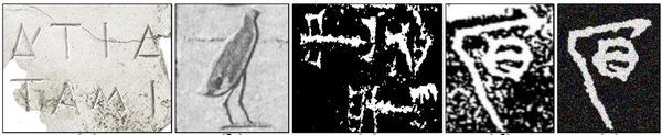
We also used computer vision and semi-supervised learning in vision-language models to identify the meaning of ancient logographic characters (Shi et al, 2026)
In our work on ancient logographic characters, we use the contextual meaning of the modern words and the graphic latent space to search for similar characters and meanings (Shi et al, 2026)
We also worked on fundamental approaches to training networks, experimenting with knowledge distillation and perturbation in our 2025 paper on competitive distillation (Shi et al, 2025)
A closer look at the framework for competitive distillation (Shi et al, 2025)
We develop AI and computer vision methods to extract knowledge and information from a range of different sources.